Navitas Energy, developers of the proposed Roanoke Windfarm has issued a map of the locations of the 50 wind turbines to be erected in the Minonk and Benson area.
Navitas said the project will have 16 turbines within a 1.5 mile radius of Benson, the closest turbine being located .6 miles from the Benson boundaries. County regulations require turbines to be at least 750 feet from residences, however, Navitas has committed to using 1,200 foot setbacks fro non-participating homes.
Navitas stated that any village or city may provide input on subdivisions which are outside their boundaries, but within a 1.5 mile radius of the community and is often called a "planning radius". However, Navitas said this does not apply to wind turbines. Navitas stated it will consider the Village of Benson request to oppose any turbines within 1.5 miles of the village boundaries, "but has no legal obligation to restrict development of wind turbines within the planning radius."
The map shows that there are 2 turbines that will be less than a mile from the city limits of Minonk and 1 turbine that will be within 1.5 miles of the city boundaries. The Minonk City Council has retained a law firm to determine what rights the City has in the placement of the turbines within 1.5 miles of its boundary.
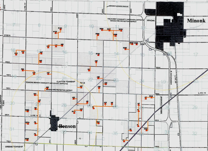
Below is a map showing the proposed locations of the wind turbines which are marked in red. It is assumed that the gray areas are designated sites for future turbines although that was not explicitly stated in the brochure released by Navitas.